One of Maine's finest ridge hikes — two 4,000-foot summits connected by an open alpine ridge with views stretching from Katahdin to the White Mountains.
Bigelow is the kind of mountain that earns its reputation. The traverse from West Peak (4,145 ft) to Avery Peak (4,088 ft) is one of the longest stretches of above-treeline walking in Maine outside of Katahdin — nearly a mile of open ridge with exposure on both sides and views that reach Katahdin on a clear day.
Route: Fire Warden’s Trail
The Fire Warden’s Trail is the standard approach, leaving from the Stratton Brook Pond trailhead off ME-27. It climbs steadily through hardwood and spruce before breaking out onto the West Peak ridge.
Key landmarks:
- 1.8 mi — Flood’s Falls, a good rest stop with water
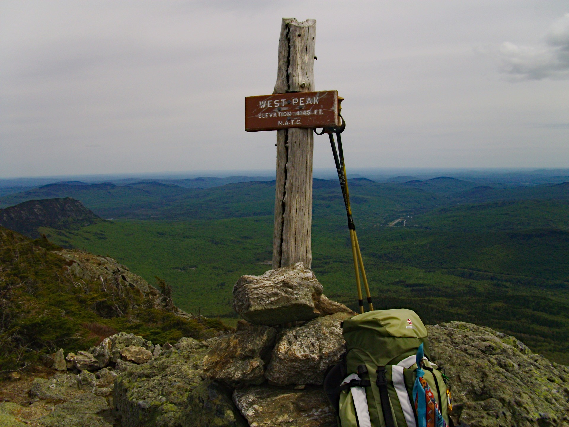
- 4.2 mi — West Peak summit (4,145 ft) — first open views open north toward Flagstaff Lake
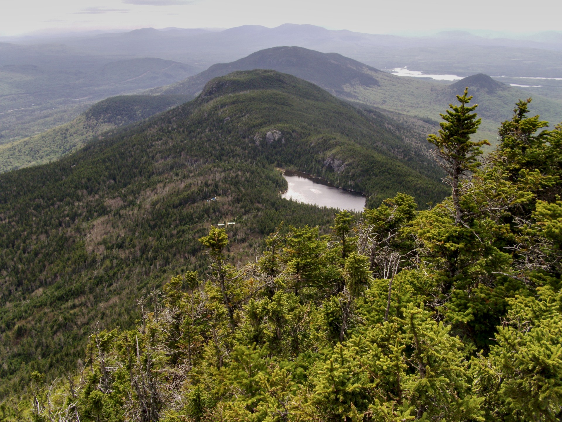
- 5.0 mi — The col between peaks; the ridge walk begins here
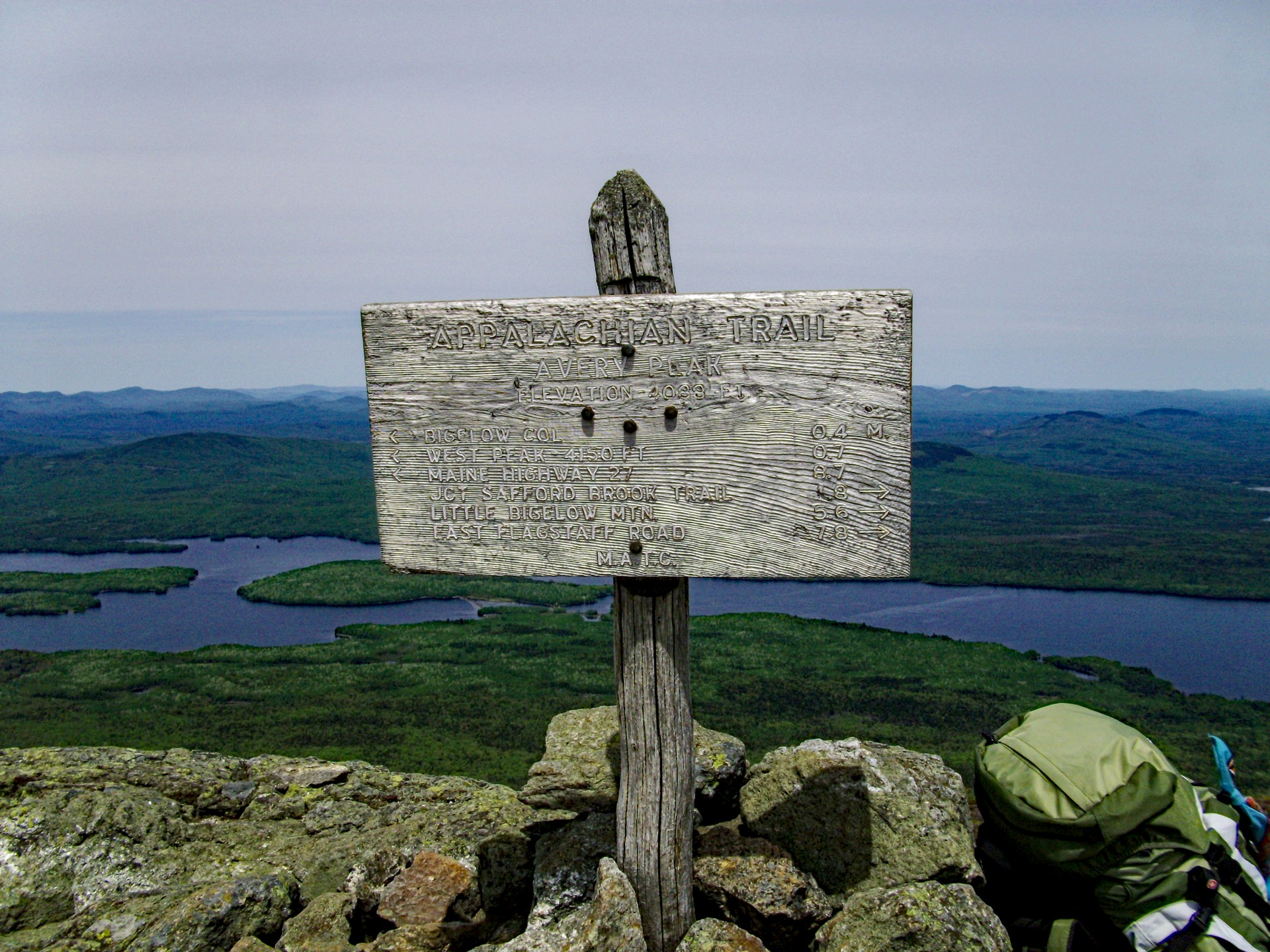
- 5.6 mi — Avery Peak (4,088 ft) — AT junction, views south and east
The Ridge
The col between West and Avery is the heart of the hike. On a clear day the panorama is staggering — Flagstaff Lake to the north, the Sugarloaf massif to the southeast, and on exceptional days, the faint silhouette of Katahdin 90 miles northeast.
Avery Peak
Avery Peak is the eastern summit and the AT crossing point. The summit is open granite with a small cairn. Named for Myron Avery, the Maine hiker who was instrumental in completing the Appalachian Trail in the 1930s.
Getting There
From Kingfield, take ME-27 north approximately 14 miles. Turn right onto Stratton Brook Pond Road (gravel, passable by standard vehicles in summer). Trailhead parking is at the end, about 1.5 miles in.
Planning Notes
- No permit required; this is state land (Bigelow Preserve)
- Dogs allowed on leash
- Water available at Flood’s Falls; treat before drinking
- The ridge is fully exposed — turn back if afternoon thunderstorms develop
- Snow on the upper ridge can persist into May; microspikes recommended through early June