Maine's finest alpine ridge — two 4,000-foot AT summits, overnight camping at Horns Pond, and sweeping views of Flagstaff Lake and Sugarloaf.
The Bigelow Range is the best overnight hike in western Maine. Two 4,000-foot summits connected by a mile of open alpine ridge, a backcountry lean-to at Horns Pond, and — if the weather holds — views that reach from Sugarloaf to Flagstaff Lake to the faint outline of Katahdin 90 miles northeast. The loop via Horns Pond Trail and the Firewarden’s Trail is the classic route, and for good reason.
The Route
The standard loop starts and ends at the Stratton Brook Pond trailhead on Stratton Brook Pond Road off Route 27. Most hikers go counterclockwise: Horns Pond Trail up, AT south to West Peak, AT north to Avery Peak, Firewarden’s Trail down.
Key landmarks:
- 0.0 mi — Stratton Brook Pond trailhead
- 3.8 mi — Horns Pond lean-tos (AT shelter, camping, water from pond)
- 5.5 mi — The Horns — two rocky sub-summits with first open views
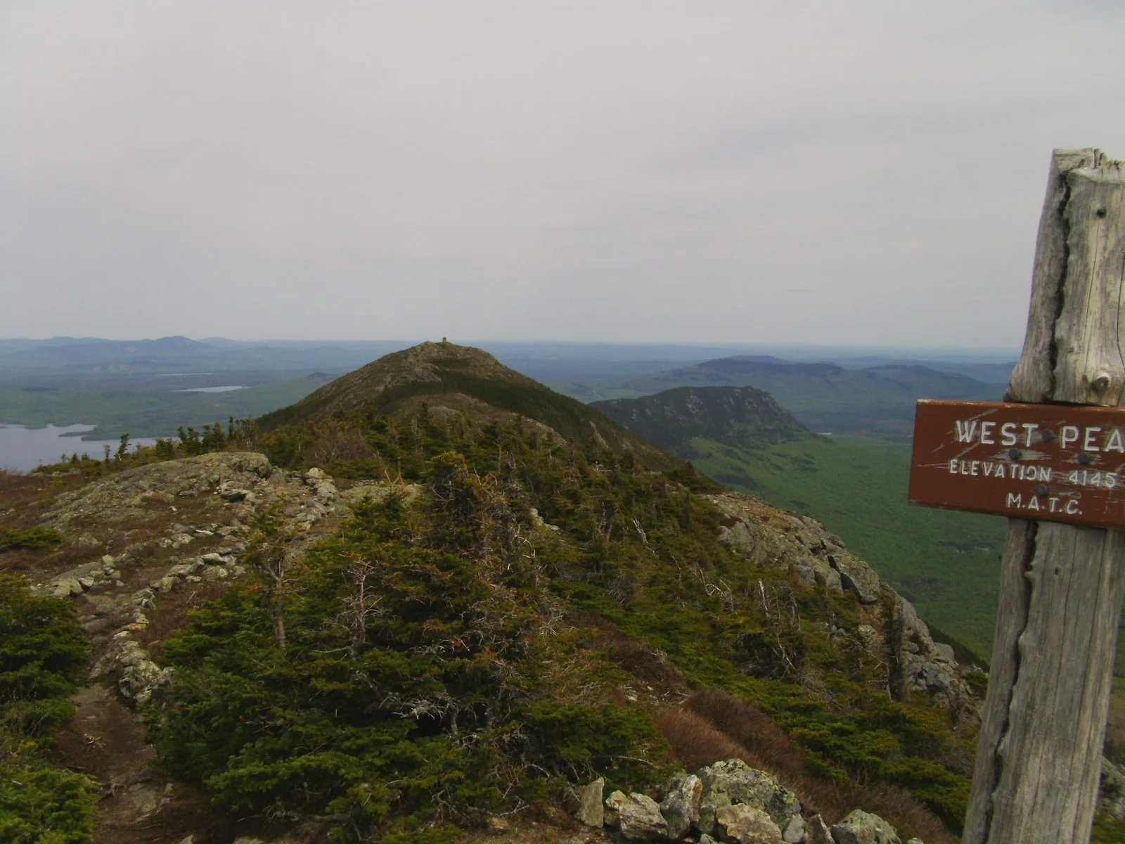
- 7.0 mi — West Peak (4,145 ft) — summit cairn, views south to Sugarloaf
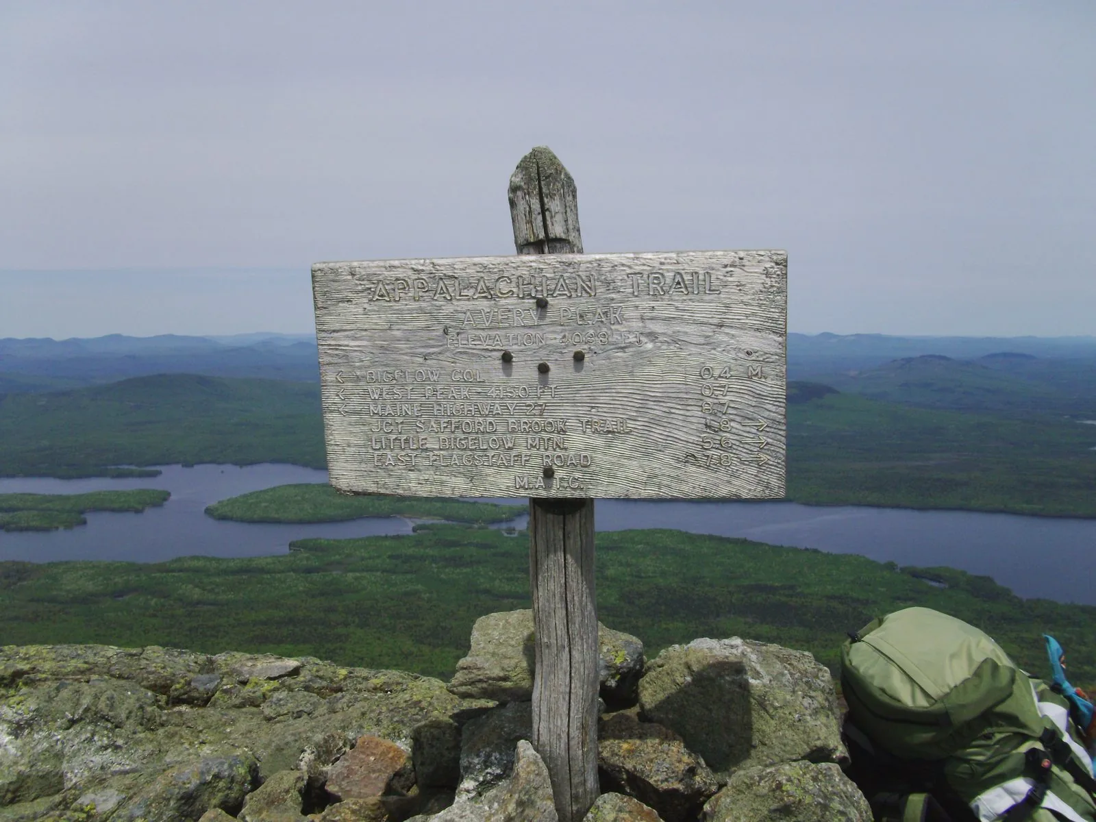
- 8.2 mi — Avery Peak (4,088 ft) — AT marker, Flagstaff Lake directly below
- 13.0 mi — Back at trailhead via Firewarden’s Trail
The Ridge
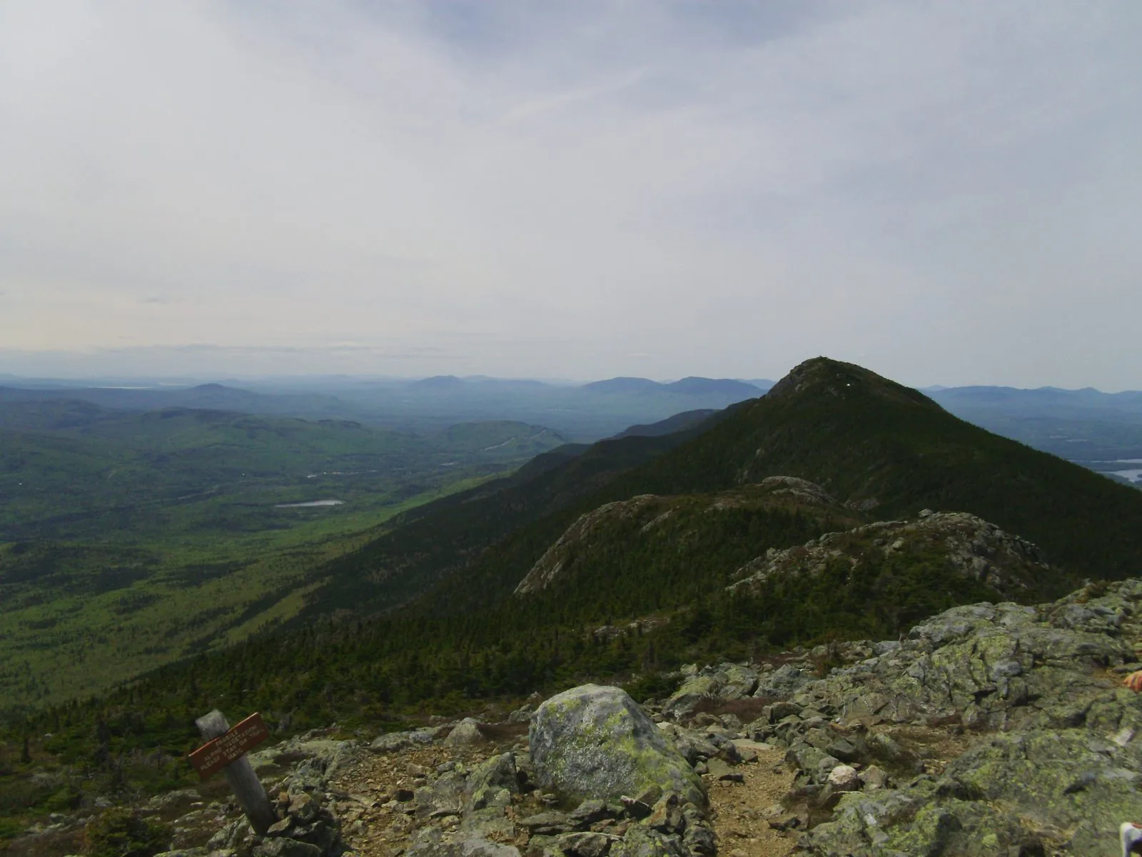
The traverse between West Peak and Avery Peak is the payoff. Nearly a mile of open granite with almost no tree cover — on a clear day you get Flagstaff Lake to the north, Sugarloaf’s ski runs to the southeast, and a sense of scale that’s hard to find outside of Baxter.
Avery Peak
Avery Peak is the AT crossing point and the eastern high point of the range. The summit marker sits at 4,088 ft with Flagstaff Lake filling the valley directly below. The peak is named for Myron Avery, the Maine native who drove the completion of the Appalachian Trail in the 1930s — fitting that his name is on a summit the AT actually crosses.
Camping: Horns Pond Lean-tos
The Horns Pond lean-tos are an AT shelter at 3,150 ft, about 3.8 miles in. Water from the pond (treat before drinking). Tent sites are available around the lean-tos if the shelters are full. This is the right place to split a loop into an overnight — arrive by mid-afternoon, set up, and tag the summits the next morning with a light pack before descending the Firewarden’s Trail.
The lean-tos are managed by the Maine Appalachian Trail Club (MATC). First-come, first-served.
Wildlife
The lower Horns Pond Trail passes through classic moose habitat — boggy softwood flats and beaver ponds. Early morning in June you have a reasonable chance of a close encounter. Give them distance.
Logistics
Trailhead: Stratton Brook Pond Road, off ME-27 north of Kingfield. The road is gravel; standard vehicles are fine in summer. The trailhead is about 1.5 miles in from Route 27.
Fees: None. Much of the range is managed by the Maine Appalachian Trail Land Trust.
Season: June through October. Avoid early spring — the lower trails turn to mud through mid-May, and snow can linger on the upper ridge into early June. Late June through September is the sweet spot.
Dogs: Allowed on leash.