Katahdin is not a hike you show up for. It’s a hike you plan, and the planning starts months earlier than most people expect. This is the guide I wish I’d had before my first attempt — the one that covers the logistics that the official park website buries and the details that only matter once you’re actually on the mountain.
See the full trail guide for route details, GPS coordinates, and stats.
The Reservation System: Start Here
Baxter State Park manages Katahdin access through a day-use reservation system. This is the single most important logistical fact about hiking the mountain:
Reservations open in early February and sell out within hours.
Not days. Hours. Peak summer weekends — July and August Saturdays — are gone by 9am on opening day. If you’re planning a summer trip, you need to be at your computer on the February opening date, logged into the BSP reservation system, and ready to book the moment the window opens.
What you’re reserving: a day-use parking spot at one of the Katahdin trailheads (Katahdin Stream Campground for the Hunt Trail, Roaring Brook for the Chimney Pond / Knife Edge approach). The reservation is per-vehicle. Without it, the ranger will turn you away at the gate.
Practical steps:
- Create a Baxter State Park account before February — don’t wait
- Decide your target date and have backup dates ready
- The park website updates the exact opening date and time in January
- Failure to cancel a reservation you can’t use is a strike against your account — cancel as soon as you know
Walk-up availability: Exists, but is unreliable. Rangers release unclaimed reservations at 7am the day of. Arriving at 6am and hoping is a strategy, not a plan.
Which Trail?
The Hunt Trail is the classic approach and the AT route — 5.2 miles to Baxter Peak from Katahdin Stream Campground, 4,188 feet of gain. It’s the route most people do and the one this guide assumes.
Abol Trail is shorter (3.8 miles) but more exposed and eroded, with a steep loose section above treeline that’s unpleasant in wet conditions. Some experienced hikers prefer it; first-timers generally don’t.
The Knife Edge loop: If you’re capable and the weather is right, descend via the Knife Edge to Chimney Pond and walk out to Roaring Brook. This requires starting from Roaring Brook or having a car shuttle. It adds distance but is the definitive Katahdin experience.
The Knife Edge Decision
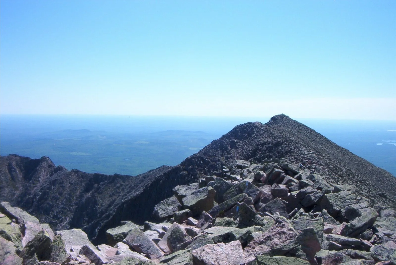
The Knife Edge is a 1.7-mile arête connecting Baxter Peak to Pamola Peak, with drops of 1,000 feet on both sides. It is not a scramble — it’s an exposed ridge walk with some sections less than four feet wide. Most fit, non-acrophobic hikers can do it in good conditions. A few things should stop you:
- Wind. Above 20mph sustained, the Knife Edge becomes genuinely dangerous. Above 30mph, don’t go. Check the Baxter State Park mountain forecast, not the general Maine weather.
- Wet rock. Rain or morning frost on the Knife Edge dramatically changes the calculus. The granite is grippy when dry and ice-like when wet.
- Late afternoon. If you won’t hit the Knife Edge until 2pm, reconsider. Afternoon thunderstorms develop fast on the tableland and you cannot descend the arête in lightning.
- Your honest assessment. Watching a video of the Knife Edge is not the same as being on it. If exposed heights genuinely bother you, this is not the place to test your limits for the first time.
If you decide against it: that’s the right call. Katahdin via the Hunt Trail out and back is still one of the best days in New England hiking.
Timeline: What a Good Day Looks Like
Katahdin is an 8–10 hour day for most hikers. Here’s a realistic schedule:
- 5:30am — Wake up at Katahdin Stream Campground (if camping) or arrive at the parking area
- 6:00am — On trail. Headlamp optional but brings margin
- 7:15am — Katahdin Stream Falls (1.1 mi). A rest stop, not a long break
- 9:00am — Treeline (2.8 mi). Views open. Wind picks up
- 10:30am — Thoreau Spring (4.5 mi). Filter water here; last reliable source
- 11:30am — Baxter Peak (5.2 mi). Lunch, photos, 20-30 minutes
- 1:00pm — Start descent or enter Knife Edge (if going)
- 3:30–4:00pm — Back at trailhead
Starting after 7am compresses your margin. The park asks that hikers turn around by 2pm if above treeline — that’s a real guideline, not a suggestion.
Gear: What Actually Matters
The trail guide has a full gear list. A few things that specifically matter on Katahdin:
Waterproof boots with ankle support. The upper Hunt Trail is granite boulder-hopping. Rolled ankles on the descent are the most common injury. Trail runners are not adequate for the rocky upper section.
Wind and rain layers. Not a rain jacket sitting at the bottom of your bag — accessible, on or over your pack. Conditions change in 20 minutes above treeline.
Trekking poles. Essential for the descent. The Hunt Trail’s upper section is relentless on the knees going down. Two poles are better than one.
Water. Fill up at Katahdin Stream before you start. The only reliable source on the mountain is Thoreau Spring at 4.5 miles. Carry at least two liters from the trailhead.
Start time is gear. Leaving at 6am instead of 8am is equivalent to two hours of insurance. It costs nothing and buys your margin against weather, fatigue, and the Knife Edge timing problem.
Common Mistakes
Driving up from Portland the morning of. It’s a 3.5-hour drive. Add traffic, the Millinocket fuel stop, and the park access road and you’re not at the trailhead until 9am. Camp the night before.
Underestimating the descent. The Hunt Trail up is 5.2 miles of sustained climbing. Down is harder on the joints and slower on the boulder sections than people expect. Budget more time for descent than ascent.
Skipping the Chimney Pond ranger check-in. If you’re doing the loop via Knife Edge, check in with the Chimney Pond ranger on your way through. They track hikers on the mountain.
Ignoring the summit weather forecast. The general forecast for Millinocket or even Baxter State Park does not represent summit conditions. BSP posts a specific mountain forecast — read it the evening before and the morning of.
A Few Things No One Tells You
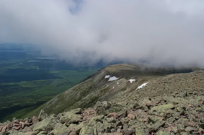
Katahdin Stream Falls at 1.1 miles is a genuine waterfall worth pausing for, not just a waypoint. The tableland — the flat alpine plateau below the summit — feels disorienting in fog because it’s enormous and the cairns are the only navigation. And the AT northern terminus sign at Baxter Peak draws thru-hikers finishing their 2,190-mile journey from Springer Mountain, Georgia. If you arrive when one does, watch. It’s worth five minutes of your summit time.
The mountain will be there on the clear day you planned for. Book in February.