The crown jewel of Maine hiking — a demanding full-day adventure to the northern terminus of the Appalachian Trail and Maine's highest peak.
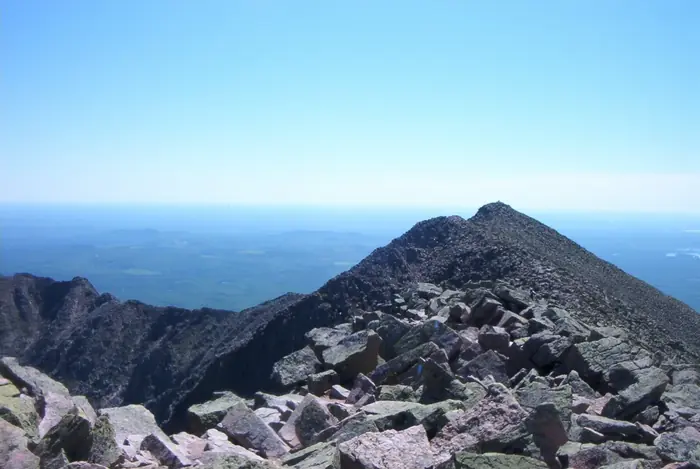
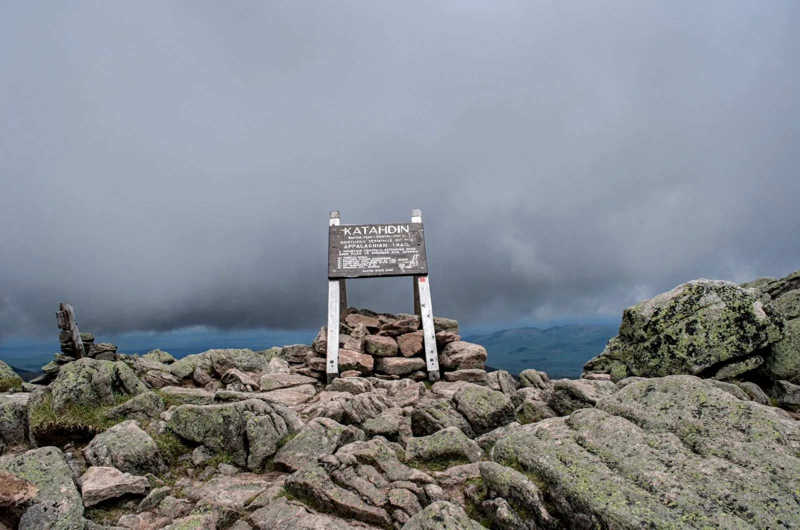
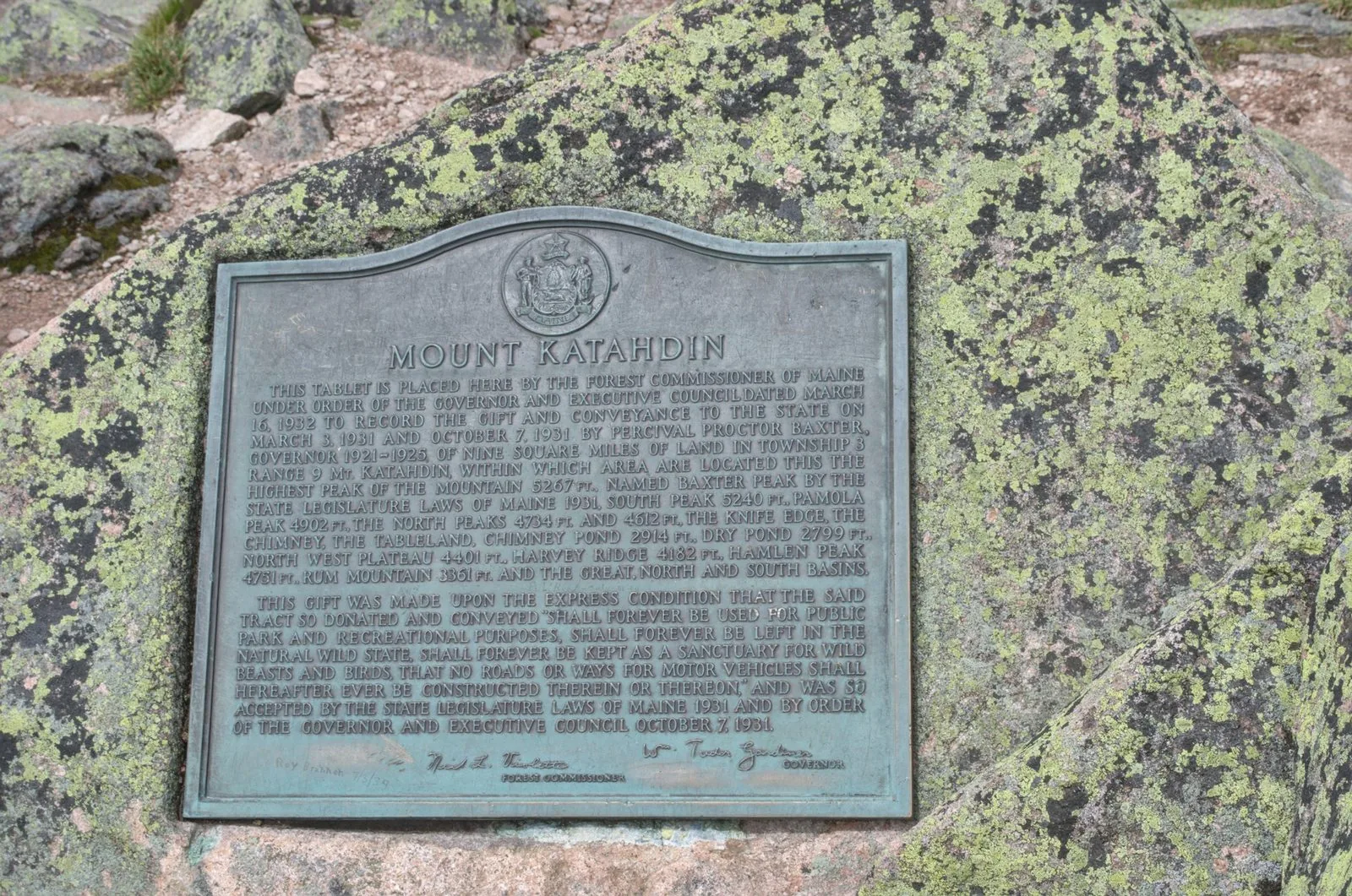
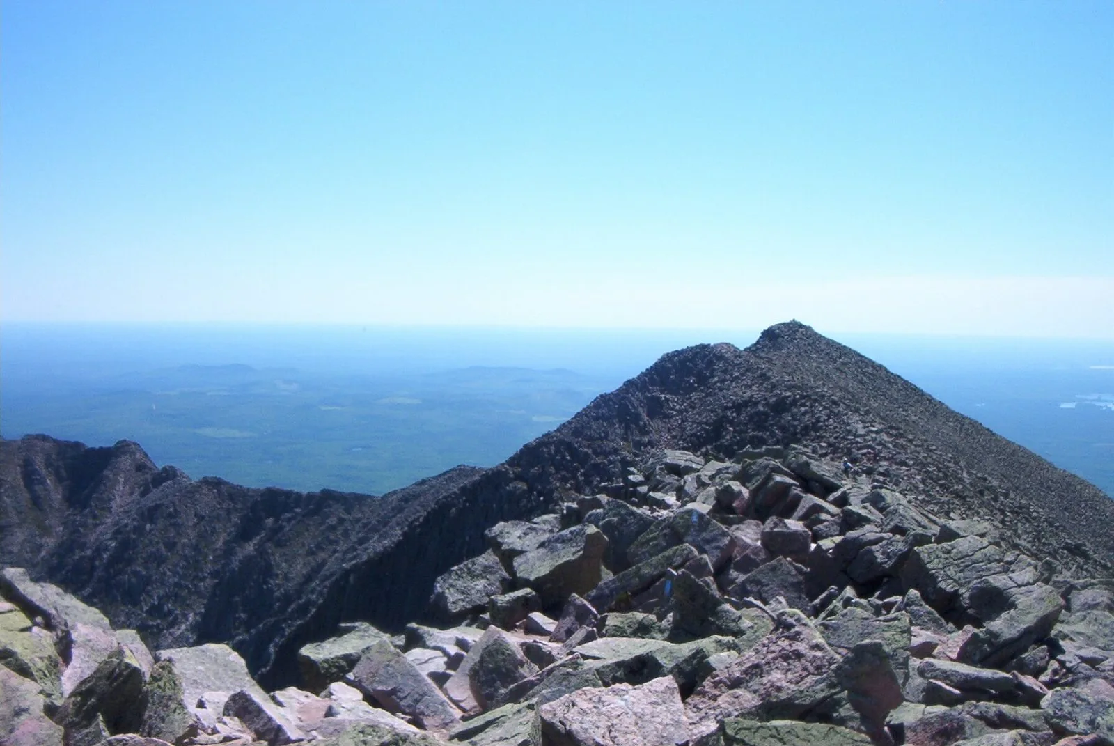
Katahdin is Maine. Standing at 5,267 feet above sea level, the Knife Edge and Baxter Peak define what serious hiking looks like in the Northeast. The Hunt Trail — the AT approach — is the classic route, combining relentless climbing with one of the most celebrated summit experiences in the eastern US.
Trail Description
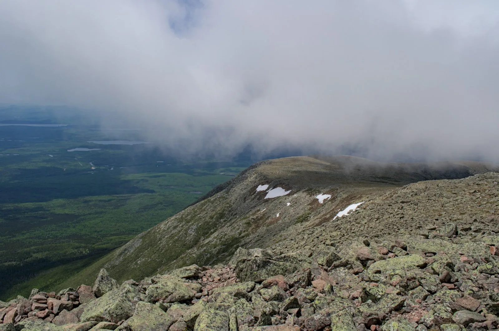
The Hunt Trail begins at Katahdin Stream Campground and wastes no time. It passes Katahdin Stream Falls at 1.1 miles before entering the treeless “tableland” — a vast alpine plateau dotted with cairns — and finally the exposed scramble to Baxter Peak.
Key landmarks:
- 1.1 mi — Katahdin Stream Falls (great rest spot)
- 2.8 mi — Treeline; views open dramatically
- 4.5 mi — Thoreau Spring
- 5.2 mi — Baxter Peak (5,267 ft), AT northern terminus
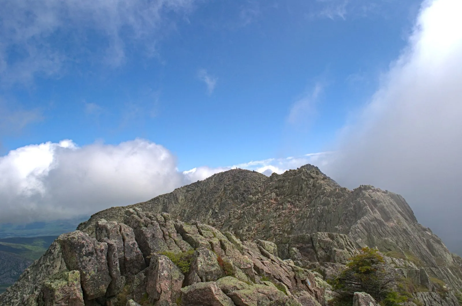
The Knife Edge Option
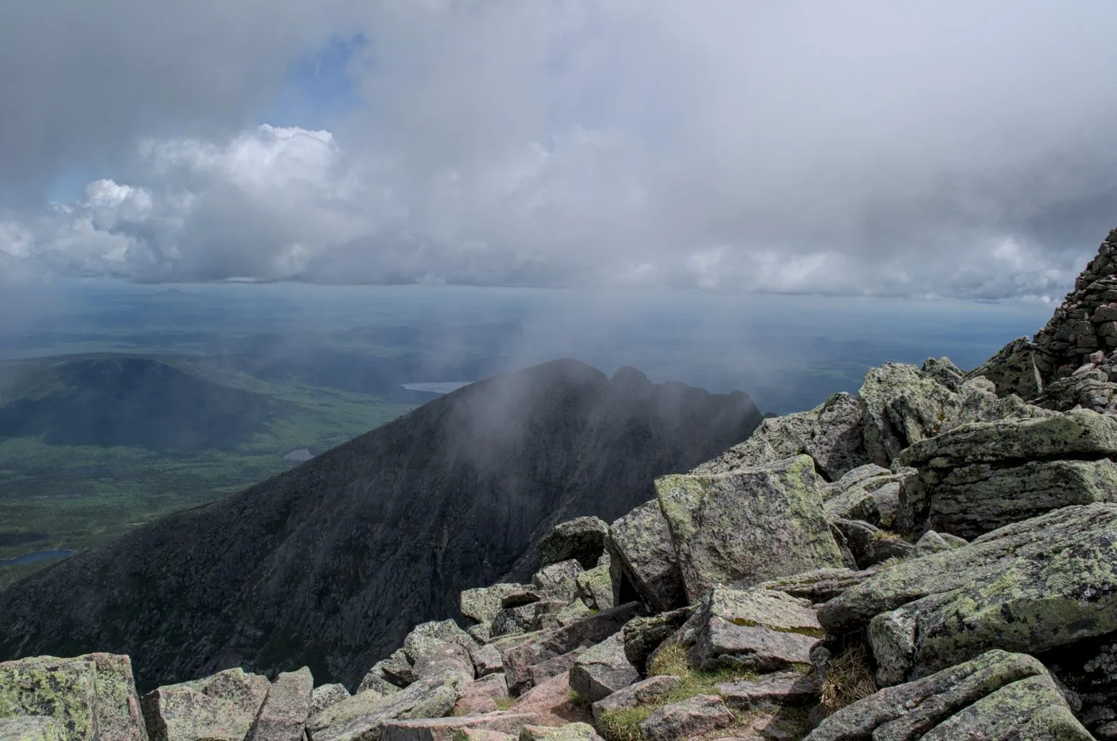
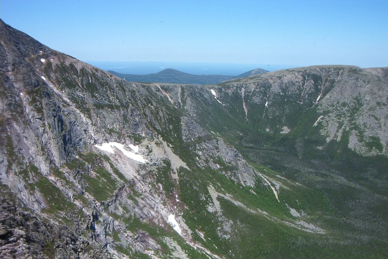
Descending via the Knife Edge to Chimney Pond and back via Saddle Trail makes for a 10.4-mile loop — unforgettable but not for those with a fear of heights. The Knife Edge is a narrow arête with 1,000-foot drops on both sides.
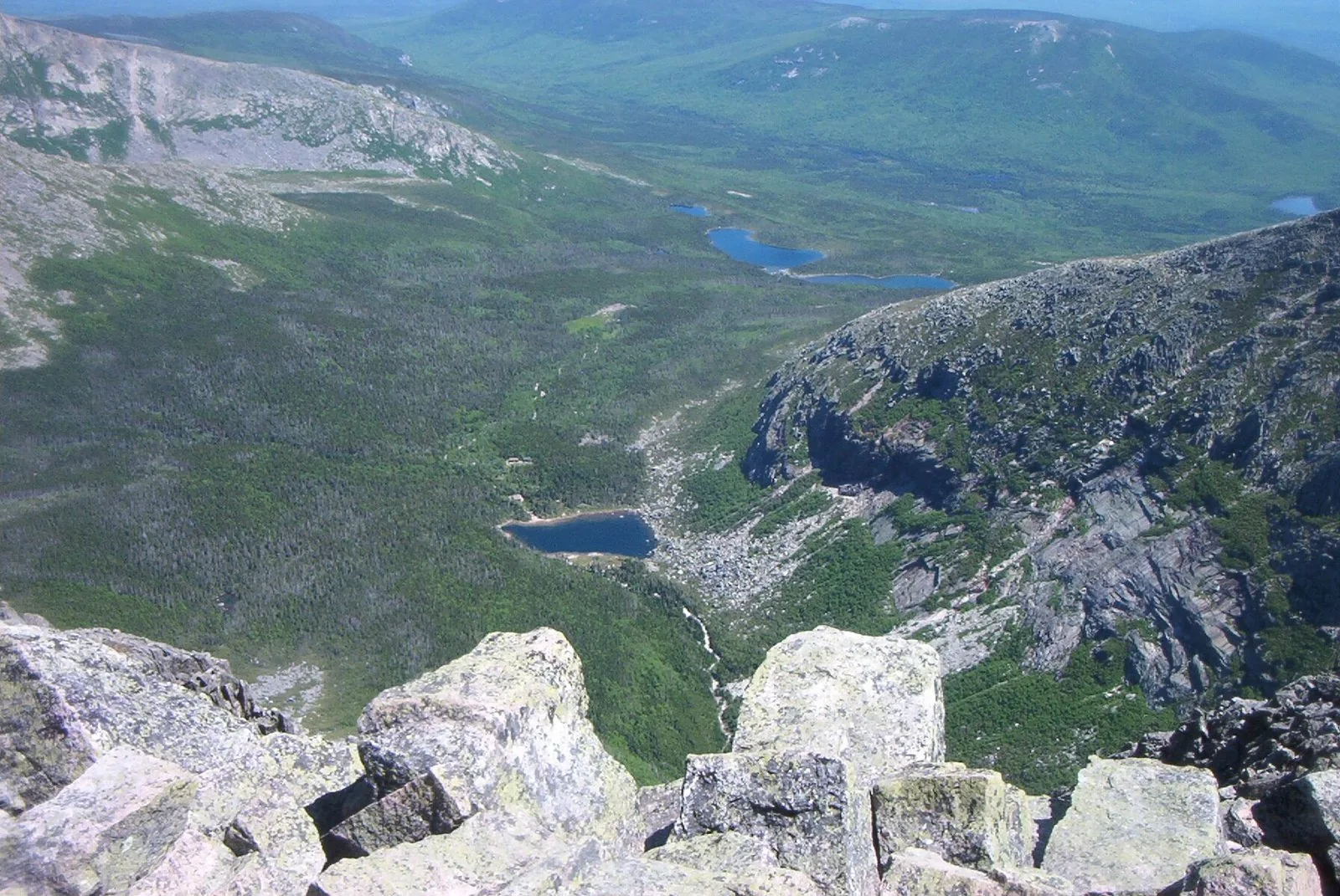
The view down into the South Basin from the Knife Edge is one of the most dramatic in the Northeast — Chimney Pond sits directly below at 2,914 ft, the ranger station visible as a small orange square at the bottom of the cirque. The two ponds visible in the far lowlands are Togue Pond.
Wildlife
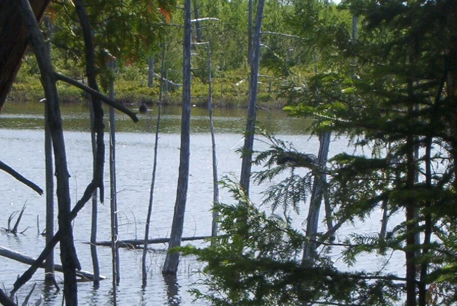
The approach to Katahdin through Baxter State Park passes through prime moose habitat. Sandy Stream Pond, a short walk from Roaring Brook Campground, is one of the most reliable moose-viewing spots in Maine — moose wade in the shallows to feed on aquatic vegetation, often in full view at close range. Early morning in June and July is the best window.
Permits & Planning
Baxter State Park requires advance reservations for day hikes on Katahdin. Reservations open in early February and sell out within hours. Katahdin is open for hiking from June through mid-October depending on conditions.
- Park entry is $15/vehicle (Maine residents free)
- No dogs on Katahdin
- Start by 7am for an 8+ hour round trip
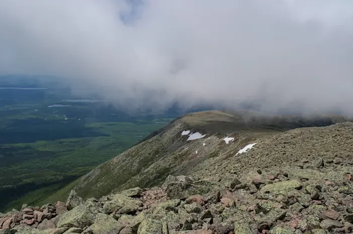
- Summit can be in clouds when the base is clear — check the BSP weather forecast
Difficulty Note
This is a genuine all-day objective for fit hikers. The upper section involves 3rd-class scrambling over wet granite. Turn around if afternoon thunderstorms develop — the tableland offers zero shelter.